

I’m just back from a weekend conference for outdoor educators held at the Clemmie Gill School of Science and Conservation (SCICON), an amazing 1,100 acre property in the western Sierra Mountains.
I’m just back from a weekend conference for outdoor educators held at the Clemmie Gill School of Science and Conservation (SCICON), an amazing 1,100 acre property in the western Sierra Mountains.

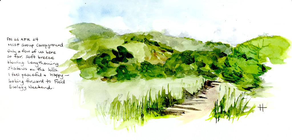
This was my fifth Field Ecology Weekend, and my fourth as an organiser. I dare to say it was the best one ever. Fifteen different presenters educated we docents on a wide range of topics over several days. A good time was had by all.

After camping at Wildrose, we took a detour to Aguereberry Point to see what are arguably the best views of Death Valley. We’re looking at the lowest point in North America — the white salt flats of Badwater Basin 282 ft (86 m) below sea level.

We took Harry Wade Road, a ‘remote and seldom-traveled route’, to the desert oasis of Saratoga Springs. The road was in surprisingly good shape and we arrived at the springs at least an hour before dusk, too early to see much bird activity. We might have waited there for the sun to get lower, but Bodie was NOT enjoying the heat (95°F/35°C) and we still had a distance to go before getting back on a tar road.
I have no illustrative evidence of the worst road we drove in Death Valley; suffice it to say that we could have died. No links, because I don’t want you to go there.

Years ago, I took a guided tour of Little Petroglyph Canyon, deep within the Naval Air Weapons Station at China Lake. It’s a truly amazing place, with over 20,000 documented Coso petroglyphs. These sculptures in the gardens of Maturango Museum in Ridgecrest are based on some of those images.
I’d love to take K back to the canyon, but they stopped allowing tours at the start of Covid and have never resumed them. I’m really glad I got to go when I did.

On the way to Death Valley, we did a little off-roading in the El Paso Mountains Wilderness. We stopped at the abandoned Holly Ash Mine to stretch our legs. There were all these huge rusted metal cones lying around, generously pock-marked with bullet holes. This one had been painted with an imagined animal skeleton.

This was my fourth Field Ecology Weekend, and my third as an organizer. The weather was capricious this time, but we gamely carried on through cold nights and a very wet morning. Attendance was great, spirits were cheerful, the learnings were valuable … and I’m exhausted (but happy).

Alli and I had a lovely afternoon enjoying the best of Gaviota.

Yep, it was a raccoon — we heard a lot of chittering and hissing as we tried to sleep.
Every year, the Malibu Creek and Topanga Canyon Docents gather for a weekend of camping, outdoor education, and camaraderie, known as Field Ecology Weekend. I’m just home from the 38th Annual FEW. Speaking as one of the organisers, it was everything we hoped it would be.


We left Stovepipe Wells in the late morning, and headed south. The plan was to find the Geologist’s Cabin and perhaps spend the night there. 25 mi / 40 km of rough dirt road took us about two and a half hours to traverse. The location is spectacular, on a rise at the western end of Butte Valley, in full view of majestic Striped Butte rising from the valley floor. But others had arrived ahead of us. Though they graciously offered to share the space, they also told us about another cabin further down the track.
Thus we discovered Stella’s Cabin, a rough structure of stone, mud and corrugated iron, once home to prospectors Clint and Stella Anderson. Stella stayed on alone for five years after Clint’s death in 1973. Having lived in similarly primitive conditions in my younger years, I felt right at home. The wood stove worked fine, and we spent a cozy night on the floor. In the morning we contributed some doggerel to the visitors’ log, before starting the long trek home.
Stella’s Cabin was for sure the cherry on top of a fabulous Death Valley visit. We just hope we didn’t contract hantavirus from all the rodent droppings🤞🏻.
